LAND USE
future land use areas
The future land use areas defined below and delineated on the Future Land Use Map create a framework for decisions related to growth, development, and conservation throughout the region. These designations recognize existing settlement patterns, the availability of existing and planned public infrastructure that can support development, and land use policies established in existing town plans. The future land use areas also represent a vision for the region that responds to the background issues described above and complies with state land use goals. There may be cases where existing land uses are inconsistent with the future land use district they fall in, for example a school campus that is located in what is otherwise a rural area. In these instances, the Regional Plan policies that are more aligned with the existing land use will be used.
The future land use areas are:
- Regional Centers
- Villages
- Hamlets
- Rural Residential
- Productive Rural Land
- Resource Lands
- Critical Resource Areas
In addition to the seven land use categories above, the following other land use classifications with special characteristics are shown on the Future Land Use Map and described in the section below:
- Commercial Nodes and Corridors
- Industrial
- Resort Center
Regional Centers
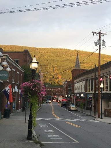
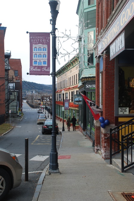
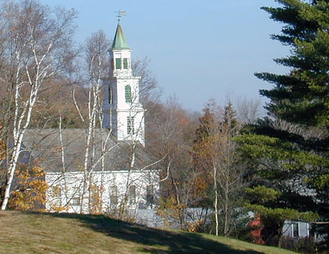
Regional Centers are areas that include a core civic and business district as well as surrounding mixed-use neighborhoods. These areas provide services, shopping, housing, and employment opportunities to residents both within the Windham Region and in the surrounding regions and states. Multi-story buildings that mix retail uses with residential and professional offices are typical. They are served by public infrastructure, including public water and wastewater systems and multi-modal transportation systems, which support the highest population densities in the region. The regional land use plan designates Brattleboro and Bellows Falls as Regional Centers.
Appropriate uses and activities in Regional Centers include a mix of uses such as commercial, residential, institutional, civic, light industrial, and public gathering spaces. The highest development densities should occur in the core of the regional downtowns, and transition to more moderate densities in adjacent residential neighborhoods. A variety of different housing types should be available in Regional Centers, with particular attention paid to housing that accommodates the region’s aging population, young professionals, families, and low- and moderate-income households.
Public transportation services and pedestrian and bicycle infrastructure are particularly important in Regional Centers. Public realm design and amenities, including sidewalks, street plantings and lighting, and public gathering spaces, are critical to support the vitality of these areas. Buildings should be oriented to the street in order to create a functional and pleasant environment.
Village
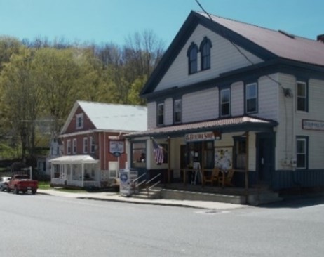
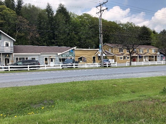
Most of the Windham Region's towns have village centers that provide for a mix of residential, commercial, service, small industry, and community facilities. This plan recognizes Villages as future growth areas. Examples of villages in the region include Putney, Newfane, Weston, Wilmington, Jacksonville, and Saxtons River.
Villages offer many goods and services for local residents, present opportunities for local businesses and employment, and provide rural towns with a sense of place. Many villages are also important historically and culturally. The types of infrastructure available in villages varies greatly across the region partially based on the size of the community. Most villages provide a modest network of paved roads, and some have invested in wastewater treatment facilities, water systems, sidewalks, and recreational lands. The future provision of water and wastewater services is encouraged, and well-designed and maintained privately owned community water or wastewater systems may provide one avenue for achieving this goal. Villages that are not served by public water or wastewater services must limit densities to what soil conditions allow for on-site septic systems, as well as planning around existing wells and neighboring properties.
Development in villages should include concentrated areas of moderate-density residential uses mixed with neighborhood commercial, institutional, and civic uses, such as general stores, restaurants, places of worship, professional offices, medical and care-giving facilities, recreational facilities, primary and secondary schools, and higher learning institutions. Safe and convenient modes of transportation to and within the villages need to be provided, including pedestrian, bicycle, transit, and automobile travel. Towns can better accommodate these different modes of travel and address potential conflicts through implementation of Complete Streets design principles and working with state partners.
Development in villages should include concentrated areas of moderate-density residential uses mixed with neighborhood commercial, institutional, and civic uses, such as general stores, restaurants, places of worship, professional offices, medical and care-giving facilities, recreational facilities, primary and secondary schools, and higher learning institutions. Safe and convenient modes of transportation to and within the villages need to be provided, including pedestrian, bicycle, transit, and automobile travel. Towns can better accommodate these different modes of travel and address potential conflicts through implementation of Complete Streets design principles and working with state partners.
In many villages, there are limited opportunities for growth within historic settlement areas given already existing development, small lot sizes, and other constraints. Towns should regularly assess the growth potential of villages, determine whether suitable areas for development or expansion can be found in and around existing village districts, and evaluate the appropriateness and feasibility of developing or expanding the capacity or extent of public water, sewer, and road systems.
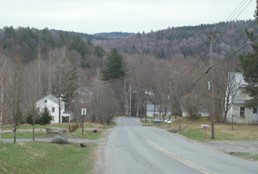
Hamlet
Though sometimes referred to as villages, Hamlets are a distinct land use that is primarily residential. A hamlet is either an existing historic cluster of residential development within a rural area or an area proposed to allow for the development of a small concentrated settlement within a rural area. Examples of hamlets in the Windham Region are Stratton, Marlboro, Windham, Cambridgeport, Brookline, and Dummerston Center.
A hamlet allows for a mixture of land uses that are consistent with the traditional settlement pattern and densities, and that do not unnecessarily duplicate services offered in the village or other commercial areas. Appropriate land uses include civic, educational, small-scale retail and service businesses, and home-based businesses mixed with the residential land uses. However, the principal land use for hamlet areas should be residential. In order to achieve traditional hamlet densities, it may be necessary to have shared water supply or sewage disposal systems.
Some towns may want to consider establishing a new village area in addition to, or as an alternative to, further development of existing villages. For example, the town of Vernon is exploring the creation of a new village center in the vicinity of its town office and school. In some situations, it may be appropriate to encourage additional growth around existing hamlets. Prior to promoting village-type development in a rural area, towns should carefully consider factors such as proximity to existing neighborhoods, the adequacy of roadways in the vicinity, soil conditions, and water supply potential. In general, this plan prioritizes most of the region’s growth and development within Regional Centers and Villages and not in Hamlets.
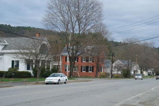
Rural Residential
Rural Residential areas include lands committed to residential development in town land use plans, or that are in proximity to already developed lands. They generally do not have access to municipal sewer and water infrastructure, and are easily accessible by the existing road network. Despite more limited access and topography constraints, many rural areas have attracted increasing residential development. Much of the peak residential growth experienced in the region between 1960 – 2000 occurred in Rural Residential areas.
These lands do not contain significant amounts of high value natural resources, and may accommodate moderate density mixed use development that is compatible with existing land uses and sensitive to the limitations of the land. As much as possible, new development should be encouraged in close proximity to regional and village centers and existing residential subdivisions. Areas with steep slopes, wetlands, adjacent to waterways, or with other environmental constraints should be avoided.
Residential development is an appropriate use at low to moderate densities, but this type of development will encourage rural sprawl if it continues to be the dominant settlement pattern. Low density development consumes significantly more land per residential unit than higher density development. As such, growth must be planned to avoid diminishing the region's rural character, degrading environmental quality, and creating excessive costs for municipalities in terms of long-term infrastructure costs. There is an opportunity to increase density in these areas incrementally by encouraging accessory dwelling units, two-family dwelling units, and small-scale multi-family dwellings where appropriate. Limited commercial uses that provide goods and services for nearby residents, such as small general stores and service stations, may be appropriate in Rural Residential areas.
Productive Rural Land
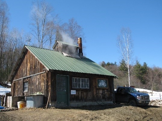
Productive Rural Lands are low density and very low-density residential areas that also contain most of the region’s land-based resources, including forestland, active agricultural lands, sand/gravel/mineral deposits, and high-value forest and agricultural soils. Productive Rural Lands contribute significantly to rural areas by providing open space and lands suitable for rural occupations and lifestyles. These lands are the traditional rural working landscape of the region, and for this reason require a high level of stewardship.
Low density residential and mixed-use development can be appropriate in productive rural land areas, but it must be compatible with working land uses, in scale with its surroundings, and sensitive to the limitations of the land. Certain small-scale industries, especially those related to agricultural and forest activities (e.g., dairy production, small-scale food processing, saw mills), may be compatible with, and most appropriate in, outlying rural areas. These types of industries are often essential for supporting the viability of agricultural and forestry businesses.
This plan also recognizes that productive rural lands may provide an opportunity for utility-scale renewable energy facilities where there is the raw potential for energy production, availability of adequate utility lines and facilities, and no environmental constraints, as further defined in the Energy Chapter of this plan. Renewable energy facilities in Productive Rural Lands must be designed to allow for the productive use of land for agricultural and forestry to the greatest extent possible.
Resource Lands
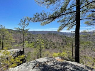
Resource Lands require special protection or consideration due to their uniqueness, irreplaceable or fragile nature, or important ecological function. Generally, these areas have not been impacted by any significant development other than very low-density residential uses or forestry activities and have limited access to local road networks. Resource lands include areas that meet at least one of the following criteria:
- Over 2,500 feet in elevation
- Identified bear travel corridor
- Area hosting significant plants, animals and ecological communities as designated by Vermont’s Nongame and Natural Heritage Program
- Area hosting federally identified endangered and threatened species or unique and fragile natural areas
- Riparian areas and their buffers
- Wetlands, floodplains, shore lands
- High Priority Forest Block or Habitat Connectivity Block as designated by the Vermont Agency of Natural Resources
- Steep slopes over 25 percent
- Scenic corridors or vistas as identified in town plans.
Resource lands must be preserved and protected to the greatest extent possible. Any development or land use in these areas should be designed to have a minimal impact on natural resources and should include effective mitigation measures that will protect natural resource values. The most appropriate uses for Resource lands are conservation and management of natural resources and limited, low impact, very low-density rural uses.
Commercial Nodes And Corridors
The Commercial Nodes and Corridors land use classification includes locations outside of traditional downtown and village centers that have been developed primarily for commercial and service industries, such as gas stations and retail operations, to support local residential populations. In the Windham Region, this type of development is largely found along segments of US 5, VT 9, VT 30, and VT 100. Much of this development has occurred since 1960 and coincides with the increases in population in more rural areas and the development of ski resorts. Some of the issues associated with this type of strip development include poor access management, lack of pedestrian infrastructure, excessive signage, lower quality buildings, and a lack of building frontage along the road.
While Commercial Nodes and Corridors are inconsistent with the goal of maintaining compact settlements separated by rural countryside, this plan recognizes that these areas provide important services for rural communities that can complement commercial areas in village and regional centers. By utilizing proper land use planning and growth management techniques, including site plan review regulations and transportation corridor planning, the negative impacts of strip development can be mitigated. The goal is to over time transform these areas into higher-density, compact, mixed use areas through infill and redevelopment while ensuring that any growth does not detract from the vitality of village and regional centers.
Industrial
The Industrial land use designation is primarily concerned with large-scale industrial and commercial development and activities that are either complementary or coexist without significant land use conflicts. These areas typically have access to transportation infrastructure, rail, water and wastewater facilities, three-phase power, and broadband and communications technology. Thoughtful planning for growth in these areas should be encouraged in order to provide jobs for residents, help retain existing businesses, and increase municipal tax bases. Examples of appropriate uses include manufacturing facilities, large-scale distribution centers, multi-tenant buildings, and business campuses that employ a high number of individuals.
This plan recognizes that large-scale industrial development has a high potential for conflict with surrounding land uses and it is appropriate to direct these businesses to the identified Industrial areas and provide mitigation for off-site impacts such as noise, traffic, and light/glare when appropriate. Landscaping or other visual and auditory screening should be provided between industrial uses and abutting incompatible land uses and major roadways. Environmental impacts of developments within this designation need to be thoroughly reviewed and adequately addressed in the early stages of project development.
Industrial activities will also take place in other parts of the region as directed by town plans, which can address the town’s needs with more specificity. Industrial uses have evolved away from higher impact heavy manufacturing uses to high-tech manufacturing and small-scale operations. These types of uses tend to have lower off-site impacts and can often be accommodated within existing village and town centers.
Resort Center
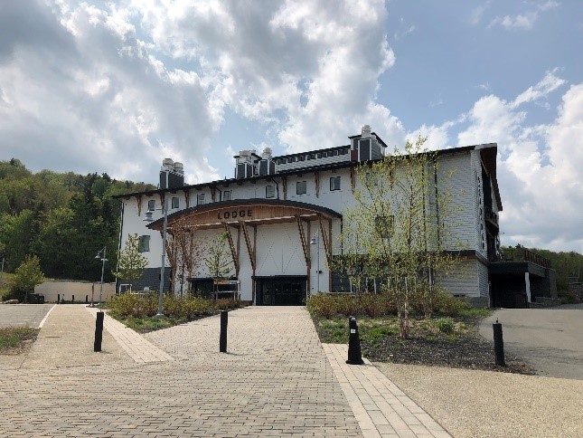
The Regional Plan recognizes the resort development concentrated around ski area base facilities as Resort Centers. This plan recognizes four Resort Centers: Mount Snow, Stratton Mountain, Magic Mountain, and The Hermitage Club at Haystack Mountain. Development in these areas includes seasonal homes, lodging, restaurants, retail businesses, and recreational equipment rentals. Resort centers have also increasingly focused on providing year-round recreational activities for residents and visitors. Some secondary development around resorts has occurred in areas that have waste water systems and are located along major roads, and as a result have been able to support higher intensity uses. However, other development is located greater distances from resort centers with lower residential densities. Over time it is possible that properties currently used for temporary lodging may become primary residences as remote work has become more common and high speed internet becomes more available and reliable.
All four resort centers are located in or adjacent to designated Resource Land areas where soils are often shallow and slopes are steep. Many streams and rivers originate from these lands, and some are productive forests and have valuable wildlife habitat. Because of these fragile natural conditions, any expansion or redevelopment must be conducted in a planned and orderly manner, take into consideration the cumulative impact of development, follow careful environmental management practices, and improve stormwater management, water quality and quantity. Expansion of commercial, retail, and residential areas must be contained, and infill development should occur as an alternative wherever possible.
Given the remote locations of the resorts and the need for an extensive seasonal workforce, provision of affordable workforce housing is critical. High-value resort and second-home properties increase surrounding property values, reducing the availability of affordable housing. To that end, there must be a balance of housing options to enhance the overall viability of a resort community. The responsibility of providing affordable workforce housing cannot fall solely on the towns and region, but instead must be a joint responsibility with resort owners and companies. Similarly, public facilities and services must not be overburdened as a result of resort development.