LAND USE
land use management techniques
The regional land use plan is implemented primarily through town plans, local land use regulations, investment in public infrastructure, and private development. In developing this plan, WRC incorporated current local land use planning goals and also considered regional goals and the compatibility of proposed land uses between towns. This section provides an overview of different approaches that municipalities can consider when implementing their town plans or making local policy decisions. WRC can support towns in deciding which strategies are the most appropriate for their communities. This section also addresses regional planning efforts WRC has identified as beneficial for the region and member towns, and community reinvestment programs available to towns.
Local Regulatory Approaches
Because regional plan policy only has regulatory bearing in Act 250 proceedings, it is up to towns to direct growth to appropriate areas within their borders. Effective zoning and zoning administration are the tools that can be used for this purpose. The proposed land use categories in this plan can be considered in local level planning efforts. Towns are encouraged to use these designations and definitions as a way to improve consistency and coordination among municipal plans, and to manage the region’s lands more effectively so that local and regional goals may be achieved.
Much of the vibrancy of our Regional Centers and Villages is due to the variety of residential, commercial, and civic uses that are found in close proximity to one another. Zoning bylaws should be written to support this mix of uses and, in village centers, to discourage large footprint retail or commercial establishments that may conflict with existing land use patterns. It is also important to support a variety of residential uses including single-family, two-family, and small multi-family buildings, which are already present in our regional and village centers. This can be accomplished by allowing more types of multi-family residential uses as permitted uses in zoning bylaws rather than a conditional use, which require additional town approvals.
Land use regulations are sometimes not in line with how villages have developed historically, even though this is the type of development pattern that residents often want to see replicated in their towns. In Regional Centers and Villages, towns should consider zoning bylaws that establish minimum lot size and building setback requirements more consistent with existing settlement patterns, such as smaller lot sizes and buildings situated towards the street, and recognize that wastewater and water infrastructure will be necessary to achieve this consistency. For towns with municipal water and sewer, it is common for lots to be as small as 4,000 square feet. In areas with public wastewater, higher residential densities should also be encouraged through increasing density limits or removing maximums.
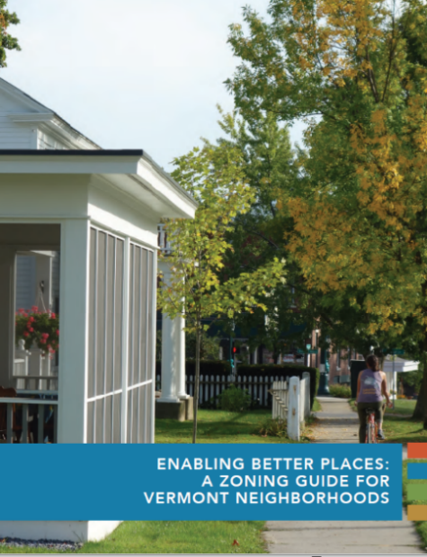
Enabling Better Places
The Vermont Agency of Commerce & Community Development (ACCD) partnered with Congress for New Urbanism to develop the Enabling Better Places zoning guide for Vermont neighborhoods in 2020. The guide focuses on incremental, small changes that communities can make to their zoning bylaws which have the biggest impact on creating vibrant and livable places. ACCD has offered funding through the Bylaw Modernization Grant program for towns to implement these recommendations. In the Windham Region, Brattleboro, Wilmington, Rockingham, and Newfane have received funding through this program.
The form of existing neighborhoods can be encouraged by adopting site plan review or design review regulations as part of zoning bylaws. These regulations can address things like the location of parking, access control, landscaping, screening, and exterior lighting, and can also include requirements on architectural design for buildings. Site plan and design review regulations can help a community mitigate potential impacts associated with development and provide property owners and developers a clear understanding of what is expected. In addition to Regional Centers and Villages, site plan review regulations should be considered in Industrial and Commercial Node and Corridor areas.
Visualizing Density
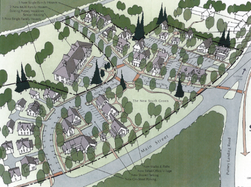
The Windham Regional Commission has assisted towns with density visualization projects to address concerns about the impact of development on infrastructure and the existing character of the community. For the Putney Visualizing Density Project completed in 2005, three sites were chosen that represented different types of development potential in the town’s village.
During a community charette, participants were asked to consider how to accommodate growth at these sites consistent with the existing small-scale rural village character of Putney. The image on the left is an excerpt from the report showing a design for a vacant site adjacent to the Putney Food Co-op that accommodates a mix of commercial, residential, and public activities. These projects can help towns develop zoning bylaws that require new development to be done consistent with the community’s vision.
Residential subdivisions in Rural Residential and Productive Rural areas should incorporate design characteristics such as walkable layouts, community identity, public open spaces, and preservation of important resources, such as agricultural soils and wildlife habitat. Many of these objectives can be achieved by clustering lots to create a hamlet-type character around homes, while setting a significant percentage of the project area aside as open space reserved for agriculture, forestry, or public recreation. This development approach is commonly referred to as conservation subdivision and it is economically efficient because road and other infrastructure requirements are less extensive and costly to construct and maintain.
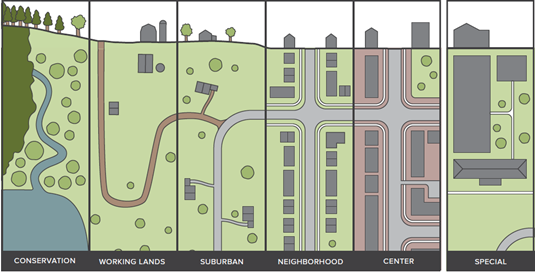
Towns can also consider developing more than one zoning district for areas identified as Rural Residential and Productive Rural to distinguish between different levels of development the community envisions for these areas. For example, it may be appropriate to have a district immediately adjacent to a village center that allows for moderate density of development and acts as a transition between the village center and more rural areas. In some cases, these areas of town may be on paved roads, supporting higher levels of traffic than dirt roads, in easy walking distance to a village center, and have access to municipal water and wastewater systems. This is commonly referred to as a “transect” approach to land use planning that encourages development on a continuum from a town center to rural settings.
Source: Vermont Agency of Commerce & Community Development
Zoning bylaws and subdivision regulations can be used to help protect forest and agricultural lands in Productive Rural and Resource Land areas. To discourage the fragmentation of large forest blocks and protect natural resources, towns can adopt large minimum lot size requirements. Local regulations can also include specific requirements on the siting of new dwellings and driveways to minimize impacts and restrict development in areas with steep slopes, high elevations, or natural resources, such as wetlands, significant natural communities, and rare, threatened, and endangered species. Overlay zoning districts are also a useful tool to protect the most critical natural resources areas or productive agricultural lands. An overlay zoning district includes more specific regulations that are in addition to the underlying zoning district. Examples of overlay districts in the Windham Region include the sensitive wildlife resource overlay district adopted by the town of Dover and the prime agricultural soils overlay district adopted by the town of Westminster.
Regional Planning
The Windham Regional Commission has a role in implementing the goals of the land use plan when it comes to addressing issues that cross municipal boundaries. WRC has identified regional planning projects that would be beneficial for the region and its member towns and it will seek to complete these projects as funding and staff availability allow.
Land Conservation Planning
This plan recognizes that land conservation planning can be more effective at the regional level with a focus on linking together parcels of land that span town boundaries and that form contiguous forest blocks and provide wildlife travel corridors. WRC will continue the work initiated under the Windham Connectivity Collaborative to map priority conservation areas in the region, meet with stakeholder groups and local partners, and assist towns with strategies for implementation at the local level.
Village Water And Wastewater Assessment
The cost of building and maintaining centralized water and wastewater systems can be high, but infrastructure planning is an integral part of encouraging infill development and compact settlement patterns. This plan recognizes that gaining a better understanding of existing infrastructure capacity and potential areas for new systems is critical to answering if, where, and how growth will occur in the region’s existing village and town centers. WRC will seek to complete a regional assessment of existing public water and wastewater systems that looks at capacity, condition, and operational issues and challenges. This study would asses the feasibility of new public wastewater systems in villages in the region where there is town interest in pursuing this infrastructure.
Community Revitalization
Reinvestment in regional centers, villages, and neighborhoods can promote compact settlement and add to the vibrancy of communities. Revitalization can happen through investment in infrastructure and public improvements, retaining local business and public services, and redeveloping brownfields and other underutilized properties.
Vermont Community Revitalization Designation Program
The Vermont Department of Housing and Community Development manages the state designation program, which provides incentives and offers towns assistances for encouraging new development and redevelopment in compact settlement areas. The following is a summary of the designation programs towns are eligible to apply for:
- Downtowns: This program provides resources to assist with downtown revitalization, including priority funding for state grant programs, downtown transportation, capital improvement funds, income tax credit for rehabilitation of certified historic buildings, and expedited review for certain Act 250 permit applications. There are three designated downtowns in the Windham Region: Brattleboro, Bellows Falls, and Wilmington.
- Village Centers: Villages that receive this designation become eligible for a number of benefits, including tax credits for building rehabilitation and improvements as well as priority consideration for state programs. Currently, the region has 27 state designated village centers: Algiers Village, East Dover, Grafton, Guilford Center, Jacksonville, Jamaica, Londonderry, Marlboro, Newfane, North Westminster, Putney, Readsboro, Saxtons River, South Londonderry, South Newfane, Townshend, Vernon, Wardsboro, West Brattleboro, West Dover, West Townshend, Westminster, Westminster Station, Westminster West, Weston, Williamsville, and Whitingham.
- Neighborhood Development Areas: Areas eligible for this designation include those within walking distance of a designated downtown, village center, new town center, or within a designated growth center. This program offers special permit and tax incentives to encourage mixed-income housing. Currently, Brattleboro and Putney are the only communities in the region with neighborhood development areas.
Towns can also apply for Growth Center and New Town Center designation. The Growth Center program designates areas that are planned for new development in keeping with historic development patterns. The New Town Center program supports the creation of an area that functions as a new downtown. No towns in the Windham Region currently have either of these designations.
Brownfield Redevelopment
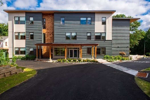
Red clover Apartments
Brownfield redevelopment is another important revitalization tool. Historically, the region hosted a range of industries, including organ manufacturers, print shops, paper mills, lumber mills and marble works, that left sites with contamination. Even properties with small businesses like gas stations or dry cleaners can require extensive cleanup. As a result, many of these sites, which tend to be located in village centers and downtowns, have been left vacant or underutilized.
The WRC established the Windham Region Brownfields Reuse Initiative (WRBRI), funded through the EPA, to help communities redevelop these challenging sites. The program conducts site assessments, cleanups, and related activities at brownfield sites. The WRBRI also provides landowners with a better understanding of the funding sources, benefits, and tax incentives available to redevelop such sites. WRC has been able to assist with numerous brownfield redevelopment projects using this program. One example shown above is the Brattleboro Housing Authority Red Clover Commons housing development in Brattleboro.
Creative Placemaking
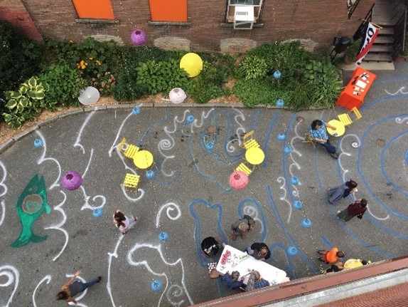
Creative placemaking refers to a wide range of arts, cultural, and, design activities meant to strengthen communities. Examples of creative placemaking including using vacant buildings for community events or art shows, testing out potential small-scale public infrastructure projects, and creating pop-up pocket parks and public gathering spaces. The overarching goal of these activities is to bring new energy and attention to village centers and downtown areas, connect people and communities, and envision ideas to build better communities. Ultimately these projects can help improve the economy and quality of life in village and regional centers and support growth in these areas.